
The Water That Would Not Drain: The Osireion, the Osiris Shaft, and the Ancient Hydrology Pattern Hiding Under Civilization
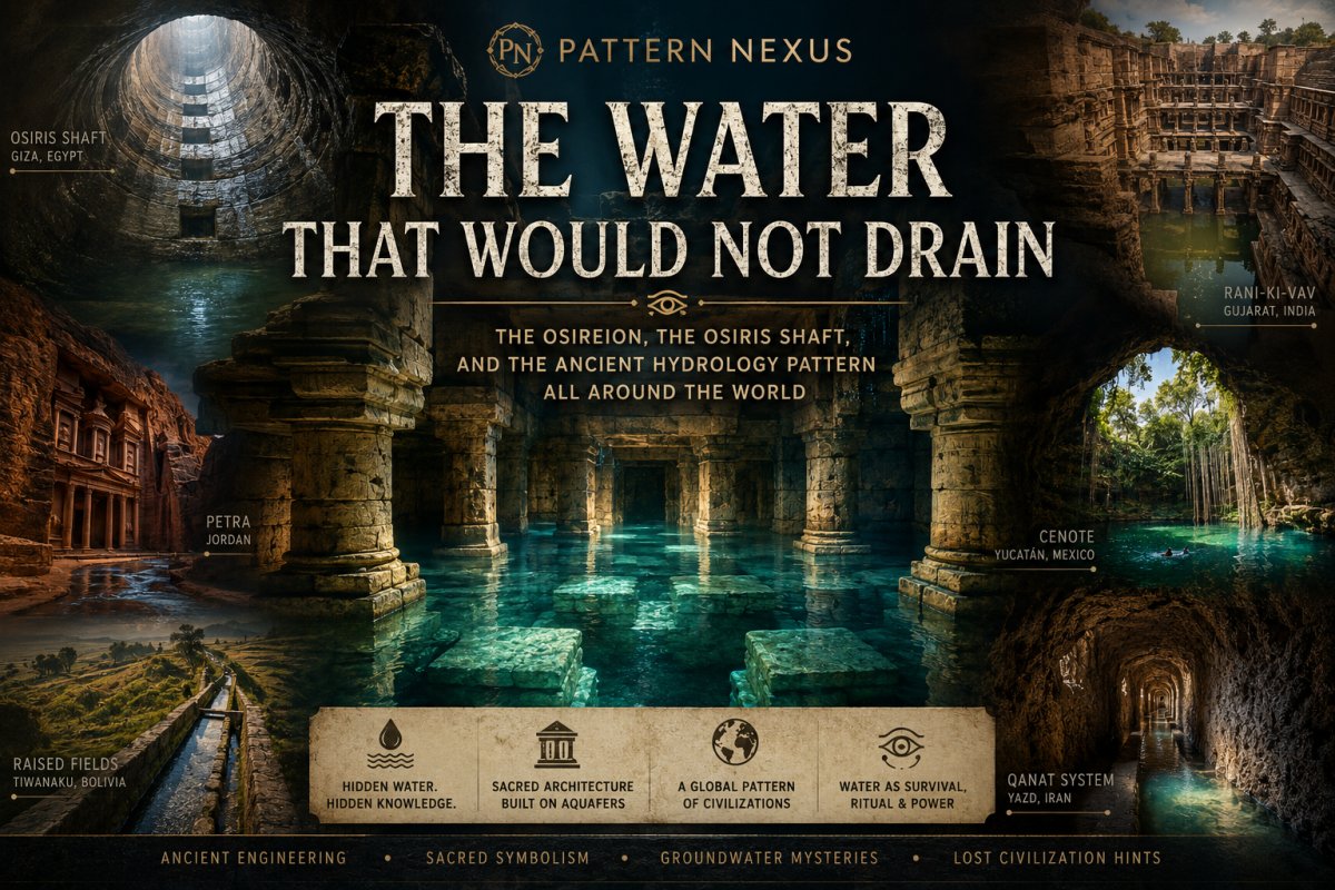
The Osireion at Abydos and the Osiris Shaft at Giza are usually treated as Egyptian mysteries, but the deeper pattern is global. Ancient builders repeatedly placed sacred architecture at the boundary between visible water and hidden water: aquifers, shafts, springs, subterranean channels, artificial islands, pressure systems, and ritual wells. This Pattern Nexus research piece separates evidence from exaggeration, examines the real dewatering problem at Abydos, corrects the stronger viral claim around the Osiris Shaft, and then maps the same hydrological intelligence across Petra, Dholavira, Mohenjo-daro, Nasca, Palenque, Angkor, Tiwanaku, Persian qanats, Indian stepwells, and Nuragic Sardinia.
Quick Read
The surface version of this story is easy to repeat: ancient Egyptian underground structures filled with water, modern crews tried to pump them out, and nobody can figure out where the water is coming from. But the real story is more precise, and the precision makes it more interesting, not less.
The strongest version of the “water that would not drain” claim belongs to the Osireion at Abydos. Modern monitoring work describes the structure as mostly submerged, with water apparently being produced from within the monument and dewatering efforts unable to keep up even at reported pumping rates of roughly 500 gallons per minute.[1] Older hydrological research tied the flooding to the Qena Sand aquifer and argued that the Nile was probably not the simple direct source because the local groundwater levels did not match that explanation cleanly.[2]
The Osiris Shaft at Giza is different. It absolutely had water problems. The lowest chamber was filled with water, and excavation was dangerous because of the high water table. But published excavation reporting says pumps were used to drain the water enough for study.[5] So the stronger claim is not “both places could never be drained.” The stronger claim is that Abydos carries the unresolved dewatering and aquifer problem, while Giza carries the ritual underworld-water architecture problem.
Once those two are separated, the global pattern opens up. Ancient builders repeatedly located sacred, civic, and defensive architecture at the boundary between visible water and hidden water: springs, aquifers, qanats, stepwells, cisterns, cenotes, barays, underground canals, pressure-fed fountains, raised-field canals, desert water tunnels, and ritual wells. Egypt is not the whole story. Egypt is one of the clearest entry points into a much older civilizational pattern.
Pattern Nexus frame: water was not just a resource. It was infrastructure, ritual, measurement, legitimacy, settlement logic, agricultural insurance, and control layer. Ancient people were not only watching the sky. They were reading the ground.
Table of Contents
- Water Was Not Background Scenery
- The Osireion at Abydos: The Strongest Pumping Problem
- What the Abydos Hydrology Actually Says
- The Osiris Shaft at Giza: Similar Symbolism, Different Evidence
- The Egyptian Pattern: Osiris, Primeval Water, and the Built Underworld
- The Global Hydrology Map
- Africa Beyond Egypt: Fossil Water and Desert Civilizations
- Middle East and Desert Hydrology: Petra, Qanats, and Aflaj
- South Asia: Reservoir Cities, Stepwells, and Inverted Temples
- The Americas: Cenotes, Maya Pressure Systems, Andean Canals, and Ancient Filters
- Asia: Angkor and Sigiriya as Hydraulic Landscapes
- Europe and the Mediterranean: Nuragic Sacred Wells
- Pattern Nexus Lens
- Evidence Layers: What Is Proven, What Is Open, What Is Overstated
- Closing Frame
- Sources
The Cleaner Claim
The Osireion has the stronger persistent dewatering problem. The Osiris Shaft has the stronger ritual underworld-water architecture. Treating them as the same thing weakens the argument.
The Pattern
Ancient societies repeatedly built sacred architecture where hidden water became visible: aquifers, springs, shafts, channels, wells, cenotes, reservoirs, and subterranean canals.
The Mistake
Modern interpretation often treats water as a preservation problem. Ancient builders may have treated it as the operating principle.
The Control Layer
Whoever controlled hidden water could control settlement, agriculture, ritual legitimacy, seasonal survival, and social organization.
Water Was Not Background Scenery
There is a type of ancient site that modern categories handle badly.
It is not only a temple. It is not only a tomb. It is not only a water system. It is not only a symbolic landscape. It sits between all of those things at once.
That is where the Osireion at Abydos belongs. That is where the Osiris Shaft at Giza belongs. And once the pattern becomes visible, it stops being an Egypt-only question.
Ancient people did not treat water the way modern people treat water. Modern systems mostly reduce water to utility: supply, drainage, sewage, irrigation, flood control, drinking water, property damage, infrastructure risk. Ancient cultures absolutely understood those practical layers, but they rarely stopped there. Water also belonged to the underworld, the womb, the ancestral realm, purification, kingship, fertility, cosmic renewal, and the return of life from beneath the surface.
That matters because the ancient world did not always separate engineering from ritual. A canal could be practical and sacred. A well could provide water and act as a descent into the hidden world. A reservoir could feed crops and mirror cosmic order. A shaft could be a tomb, a ritual stage, a groundwater interception point, or all three at the same time.
The cheap version of this subject says, “Ancient people built impossible things and modern science has no idea.” That is not the strongest argument. The stronger argument is this: ancient builders had a far more integrated understanding of landscape, water, ritual, and power than modern interpretation usually gives them credit for.
The question is not whether water mattered. That is obvious. The question is why so many sacred and civilizational sites were built at the exact boundary where hidden water crossed into visible space.

The Osireion at Abydos: The Strongest Pumping Problem
The Osireion sits behind the Temple of Seti I at Abydos. It is low, heavy, strange, and physically different from the expected temple architecture around it. The structure has massive stone blocks, a sunken central space, side chambers, and the repeated impression of an island or underworld chamber surrounded by water.
Abydos itself was not a random site. It was one of the most important sacred landscapes in Egypt, deeply tied to Osiris, death, resurrection, pilgrimage, royal memory, and the idea of sacred burial. The Osireion belongs inside that landscape, but it also behaves like something more than a symbolic monument.
The modern issue is the water.
A 2023 monitoring project described the Osireion as mostly submerged, with water emerging from within the structure and a history of dewatering attempts that could not keep up. The report specifically describes pumping at roughly 500 gallons per minute without successfully dewatering the monument.[1]
That is the core fact that makes the Osireion different from a normal flooded ruin.
If water is sitting in a hole because a site is below the water table, that is one category. If water is entering through cracks after rain, that is another. If the Nile, a canal, or modern irrigation is simply flooding a low-lying structure, that is another. But if the structure is interacting with a confined or semi-confined groundwater pathway that continues to feed it faster than practical pumping can remove it, then the site becomes a hydrological problem, not only an archaeological one.
That does not mean “supernatural.” It means the water system is alive.
The Osireion is not just an object sitting in the desert. It is inserted into geology. It is cut into depth. It is placed where stone architecture meets groundwater behavior. That is why the better question is not “why is there water?” but “why was this monument built where water could become part of the monument?”
What the Abydos Hydrology Actually Says
The Osireion water problem has been studied in a more serious way than most online summaries admit. A 1992 groundwater report by James E. Brooks and Bahay Issawi argued that the water flooding the Osireion most likely comes from the Qena Sand aquifer.[2]
That matters because the Qena Sand is not just “some wet dirt.” It is a permeable ancient channel-fill deposit that can carry groundwater through the desert-edge environment. In the model from Brooks and Issawi, the groundwater movement is generally from west to east across the Abydos region, toward the Nile Valley.[2]
That direction is important. The easy assumption would be that the Nile is simply pushing water into the structure. But the report argued that Nile water was probably not the direct source because the observed hydraulic levels did not fit that explanation cleanly. In other words, the water problem was not as simple as “the Nile is high, so the Osireion floods.”[2]
Later isotope and groundwater work complicated the picture further. A 2011 study examined isotopic and chemical data from the Osireion and surrounding wells, treating the water source as a real hydrological question rather than a decorative archaeological inconvenience.[3]
The same study is important for another reason: it notes that pumping difficulty is not new. During Henri Frankfort’s 1925 expedition, a pump lowered water in the channel enough for excavation, but groundwater inflow exceeded the capacity of a 16-horsepower steam-driven four-inch pump, limiting how deep the excavation could go.[3]
That gives the pumping problem historical depth. It is not a viral claim invented yesterday. It has a long excavation history: the site fills, people pump, the water comes back, and the structure remains difficult to study.
The Pattern Nexus reading is not that the water has no explanation. The Pattern Nexus reading is that the explanation is not separate from the monument. The hydrology may be part of why the structure exists where it does.
If ancient builders understood that this location intersected a reliable hidden water system, then the Osireion becomes more than a cenotaph. It becomes a controlled underworld scene built into a live groundwater threshold.
That would fit Osiris perfectly.
Osiris is not just death. Osiris is return. Vegetation. Flooding. Regeneration. The body in the earth. The life that comes back from below. The buried thing that becomes fertile again. If you were going to physically stage that concept, a sunken stone chamber surrounded by persistent groundwater is almost too perfect.
The Osiris Shaft at Giza: Similar Symbolism, Different Evidence
The Osiris Shaft at Giza sits beneath the causeway of Khafre. It consists of multiple vertical shafts and chambers descending into the plateau, ending in a lower chamber that contained a granite sarcophagus surrounded by water when modern excavation began.[5]
This is where the online version often gets sloppy. The Osiris Shaft did have serious water problems. The lowest chamber was filled with water. The excavation was dangerous. The rising water table made earlier study difficult. But the published excavation report says pumps were used to drain the water enough to continue excavation.[5]
So we should not force the stronger Abydos dewatering claim onto Giza. We do not need to. The Giza shaft is already fascinating on its own terms.
The lowest chamber appears to create a staged underworld environment: descent through shafts, darkness, water, sarcophagus, and Osiris symbolism. Hawass interpreted the shaft through the Osiris myth, with the descent beneath the plateau linked to the realm of Osiris.[5]
In other words, the Osiris Shaft is not a normal tomb in the clean modern sense. It is a ritual geography cut into bedrock.
The water surrounding the sarcophagus is not incidental to the impression. It creates the image of an island or body inside the primeval waters. That matters because Egyptian cosmology repeatedly works with the idea of land emerging from water, life emerging from the flood, order emerging from undifferentiated depth.

This is the correct split:
The Osireion is the stronger case for persistent groundwater inflow, pumping difficulty, and unresolved hydrological behavior.
The Osiris Shaft is the stronger case for intentionally staged Osirian underworld architecture using water, descent, and sarcophagus placement.
Together, they point toward the same Egyptian pattern: sacred water was not decorative. It was a threshold.
The Egyptian Pattern: Osiris, Primeval Water, and the Built Underworld
The Egyptian pattern matters because Egypt’s sacred geography was never just symbolic in the abstract. It was tied to real seasonal water behavior. The Nile flood was not background. It was the annual return of life. Agriculture, taxation, calendars, temple ritual, kingship, and social order were all structured around the flood pulse.
That means Osirian water symbolism was not floating in the sky as mythology. It was tied to the physical reality of Egypt: black soil after flood, crops after inundation, life after burial, order after chaos, land emerging from water.
The Osireion and Osiris Shaft should be read inside that larger grammar. Water below the ground is not just “wetness.” It is the underworld made physical. It is the hidden system beneath life. It is what returns. It is what feeds the visible world without being visible itself.
This is where modern thinking gets too thin. We separate groundwater from theology. We separate engineering from ritual. We separate site design from geology. Ancient sacred builders often did the opposite. They fused those layers.
A structure built into groundwater could be functional, symbolic, and cosmological at the same time.
That is the doorway into the global pattern.
The Global Hydrology Map
The global pattern is not that every civilization copied one original source. Sometimes cultures do transmit technology. Sometimes they independently solve the same problem. Sometimes they mythologize the same natural boundary because the same natural boundary exists everywhere humans live.
The common boundary is this: hidden water becomes visible water.
That boundary creates settlement, agriculture, ritual, hierarchy, and memory. It is not surprising that people built around it. What is surprising is how sophisticated, durable, and symbolically loaded many of these systems were.

Africa Beyond Egypt: Fossil Water and Desert Civilizations
The Garamantes: A Saharan Civilization Built on Fossil Groundwater
The Garamantes of the Libyan Sahara are one of the most important sites to bring into this discussion because they show the harsh version of the hidden-water pattern. This was not a river civilization in the classic schoolbook sense. This was desert state formation built around groundwater extraction.
Geological Society of America reporting describes how the Garamantes harvested groundwater using foggara or qanat-like systems: slightly inclined underground tunnels dug into hillsides below the water table, allowing groundwater to flow downhill into irrigation systems.[24]
The scale is the key. The Garamantes reportedly dug roughly 750 kilometers of underground tunnels and vertical shafts, with major construction activity between about 100 BCE and 100 CE.[24]
That is not a small local trick. That is a desert control layer.
The Garamantes show the darker edge of ancient hydrology too. The groundwater they depended on was largely fossil water inherited from earlier wetter climatic periods. Once a society builds itself on non-renewing or slowly renewing groundwater, the system carries a hidden countdown. It can look stable for generations while the underlying reservoir is being drained.
That is one of the oldest forms of liquidity illusion: the visible economy is growing because the invisible reserve is being consumed.
Pattern Nexus translation: the Garamantes were not just using water. They were converting buried climate memory into agriculture, settlement, trade power, and state capacity.
Middle East and Desert Hydrology: Petra, Qanats, and Aflaj
Petra: The Desert City That Turned Flood Risk Into Urban Power
Petra is one of the best examples of ancient hydrology as full civilizational design. The Nabataeans did not simply place a city in the desert and hope for the best. They built a water-control system of channels, dams, cisterns, pipelines, terraces, settling basins, and flood-diversion structures that made the city possible.
Research on Petra’s water system describes a settlement that exploited all available water resources while balancing reservoir storage with continuous-flow pipeline systems to maintain supply across seasonal conditions.[9] Other hydrological work emphasizes Petra’s flood-control design, including diversion and storage strategies in a landscape where flash floods could be devastating.[8]
This is why Petra belongs in the same discussion as Abydos, even though the sites are completely different. Petra shows water intelligence as urban strategy. It is the dryland version of the same pattern: read the invisible flow paths, control the seasonal violence, store the surplus, and turn a hostile landscape into a trade city.

The Persian Qanat: No Pump, No Engine, Just Gravity and Groundwater Literacy
The Persian qanat system is one of the cleanest examples of ancient hidden-water engineering. UNESCO describes a qanat as an almost horizontal tunnel collecting water from an underground source, usually an alluvial fan, with a mother well sunk to the aquifer and vertical shafts along the route for removing spoil and ventilation.[13]
The genius is not just the tunnel. The genius is that it avoids the pump. The water moves because the builders understood slope, aquifer level, tunnel grade, soil stability, ventilation, and long-term maintenance.
That matters because modern people often mistake machinery for intelligence. A pump is obvious intelligence. Gravity engineering is quieter. But in many contexts it is more durable. Qanats can operate for centuries because they are built into the pressure and elevation logic of the land itself.
This is the same category of thinking that makes the Osireion important. The question is not whether ancient people had our machines. The question is whether they understood the natural machine beneath them.
Oman’s Aflaj: Water Rights, Stars, and Community Allocation
Oman’s aflaj systems show the social side of hidden-water control. UNESCO describes the property as five aflaj systems representing roughly 3,000 such systems still in use. These systems channel water by gravity from underground sources or springs to support agriculture and domestic use, with archaeological evidence suggesting irrigation existed in the region as early as 2500 BCE.[25]
This is where water becomes law. Aflaj are not just channels. They are allocation systems. Water has to be divided, timed, inherited, defended, maintained, and measured. In traditional systems, distribution could be governed by time, community rules, and even astronomical observation.
That is the real control layer. The infrastructure moves water, but the social system decides who receives it, when, and under what legitimacy.

South Asia: Reservoir Cities, Stepwells, and Inverted Temples
Dholavira: A Harappan City Planned Around Water Scarcity
Dholavira, in present-day Gujarat, is one of the strongest examples of ancient urban hydrology. UNESCO describes it as a Harappan city supplied by two seasonal streams in a scarce-water region, with a sophisticated water management system demonstrating the ingenuity of its people in surviving and thriving in a harsh environment.[6]
That word “seasonal” matters. A perennial river allows one kind of settlement. A seasonal stream forces another. Dholavira had to capture, store, route, protect, and manage water across time. The city’s reservoirs, channels, and drainage systems were not decorative appendages. They were part of the city’s operating structure.
Dholavira shows the urban version of hidden-water thinking. It is not only about finding water underground. It is also about holding water across scarcity cycles.

Mohenjo-daro: Water, Sanitation, and Ritual Bathing
Mohenjo-daro is usually discussed as an early planned city, but its water and sanitation systems are the real signal. UNESCO describes public baths, wells, soak pits, and an elaborate drainage system that formed part of the city’s urban fabric.[7]
The Great Bath is especially important because it sits at the overlap of utility and ritual. It is a water structure, but it is not merely a reservoir. It appears designed for controlled access, lined construction, and public or ceremonial use. Whether one emphasizes hygiene, ritual bathing, social hierarchy, or communal ceremony, the point is the same: water was central enough to be monumentalized.
Mohenjo-daro also carries the preservation irony seen at Abydos. UNESCO notes that the site is threatened by saline action connected to a rise in the Indus River water table.[7] Ancient water intelligence becomes modern water vulnerability.

Rani-ki-Vav: The Stepwell as an Inverted Temple
Rani-ki-Vav in Patan, Gujarat, takes the water-threshold pattern and turns it into vertical architecture. UNESCO describes stepwells as distinctive subterranean water resource and storage systems on the Indian subcontinent, evolving from simple pits into elaborate multi-storey works of art and architecture. Rani-ki-Vav itself was built in the 11th century as a memorial to a king and is described as an inverted temple emphasizing the sanctity of water.[14]
That phrase, inverted temple, is the whole pattern in one image.
You do not climb toward heaven. You descend toward water.
That descent is practical because the water table changes. But it is also symbolic because the movement turns groundwater access into ritual experience. The architecture frames water as something approached, entered, and honored.

Sigiriya: Water Gardens, Gravity, and Royal Landscape Control
Sigiriya in Sri Lanka belongs in this map because its water gardens turn hydraulic knowledge into royal theater. The site is famous for its rock fortress, but the gardens below are just as important: ponds, channels, moats, fountains, and controlled water movement arranged along a formal axis.
Commons documentation for Sigiriya’s water gardens describes gravity-operated waterworks fed by underground conduits, with watercourses, pools, and low-pressure fountains that operated during the rainy season.[28]
Sigiriya is not the same kind of site as the Osireion, but it belongs in the same family because it uses water as controlled experience. The palace landscape does not merely contain water. It choreographs water.

The Americas: Cenotes, Maya Pressure Systems, Andean Canals, and Ancient Filters
Nasca Puquios: Spiral Access to Hidden Water
The Nasca puquios in Peru are among the closest global parallels to the hidden-water theme. UNESCO describes the Nasca aqueducts as a system designed to deal with water scarcity by obtaining water from deep in the soil in one of the driest regions on Earth. The system includes underground and uncovered channels and has remained at least partially operational for more than 1,700 years.[10]
The puquios are powerful because they make invisible water visible without treating it as a one-time extraction. They are access, maintenance, ventilation, and distribution architecture all at once. The famous spiral openings are not random shapes. They are part of a system that allows people to access and maintain underground flow.
Again, the pattern is not only “ancient people found water.” It is that they built durable social and agricultural systems around hidden water pathways.

Palenque: The Maya and Engineered Water Pressure
Palenque is one of the most important examples because it shows that ancient water systems could involve pressure, not just movement. Penn State reported that researchers identified the Piedras Bolas Aqueduct as the earliest known example of engineered water pressure in the New World.[11]
The feature was spring-fed and located on steep terrain. The conduit narrowed sharply near its outlet, and hydraulic modeling suggested that gravity and constriction could have produced pressurized water, possibly enough to shoot water upward.[11]
That point matters. Ancient hydraulic systems were not always passive drains. Palenque suggests empirical knowledge of water pressure: slope, narrowing, storage, and outlet behavior. They may not have used modern equations, but they understood the effect.
Palenque also had a broader water-control logic. Research on Palenque’s water management describes multiple aqueducts, dams, channels, and the use of water management to create usable urban space in a constrained landscape.[12]
In plain language: the Maya were not just building temples in the jungle. They were routing water under the city.
Tikal: Ancient Water Filtration with Zeolite
Tikal adds another layer: purification. A Nature Scientific Reports study found evidence for the oldest known zeolite water purification system in undisturbed sediments of the Corriental reservoir at Tikal. The reservoir served as an important drinking-water source during the Late Preclassic to Late Classic periods, and the study identified zeolite and quartz sand consistent with filtration use.[16]
That means the Maya were not only storing water. They were improving water quality.
This is a major upgrade in how we should talk about ancient hydrology. Storage is one level. Drainage is another. Pressure is another. Filtration is another. The Tikal evidence suggests a water-treatment intelligence that is easy to miss if we imagine ancient systems as crude ponds and simple channels.

Chichén Itzá: Cenotes as Water Source and Underworld Portal
Chichén Itzá belongs in this map because cenotes are not only water sources. They are openings into the limestone underworld of the Yucatán.
UNESCO notes that Chichén Itzá was established near two natural cavities, or cenotes, which gave the town its name and allowed access to underground water.[15]
The Sacred Cenote shows how practical water access becomes cosmological architecture. The Metropolitan Museum of Art describes cenotes in Maya cosmology as liminal spaces and portals between the earthly realm and the watery underworld.[17]
This is almost the same grammar as the Osireion, but expressed through a different geology. Egypt has floodplain, aquifer, Nile cycle, and Osiris. The Maya lowlands have limestone, cenotes, rain, caves, underworld portals, and Chac. Different civilizations, different symbols, same boundary: water rising from the hidden earth.

Chavín de Huántar: Water, Sound, and Ritual Disorientation
Chavín de Huántar in Peru adds another dimension: water as sound technology. The site includes underground galleries, channels, and ritual architecture. Research and reporting on Chavín have described canal systems that may have produced dramatic sound effects when water was moved through them, contributing to sensory and ceremonial experience.[18]
This is one of the most fascinating examples because the water may not have been there simply to supply or drain. It may have been used to manipulate perception.
Imagine entering a dark stone complex where water roars below or around you, where sound is amplified by stone galleries, where conch trumpets echo through hidden chambers, where light and darkness are staged. That is not “plumbing.” That is engineered experience.
Pattern Nexus frame: Chavín shows water as psychoacoustic infrastructure. The channel is not only moving water. The channel is moving the mind.

Machu Picchu: Springs, Fountains, Drainage, and Mountain Control
Machu Picchu is often treated visually as a mountain city, but it is also a water-management system. Engineering studies describe how the Inca captured spring flow, routed it through canals and fountains, and built drainage systems that protected the site from heavy rainfall.[19]
The key lesson from Machu Picchu is that water management was not only about bringing water in. It was also about getting water out. A mountain city without drainage becomes a landslide waiting to happen. Stone terraces, subsurface drainage, fountains, canals, and overflow routes all worked together.
Wright’s work on Machu Picchu also noted a separate series of fountains fed not by the main canal but by intercepted groundwater drainage, meaning Inca engineers recognized and captured dry-weather groundwater flow locations.[20]
That is exactly the kind of intelligence this article is tracking: not water as scenery, but water as system.
.jpg?width=1600)
Tiwanaku and Raised Fields: Water as Thermal Battery
Tiwanaku around Lake Titicaca belongs here because it shows water doing something more subtle than irrigation. Raised-field agriculture used canals around planting platforms. These canals helped with drainage, moisture, nutrient cycling, and in some interpretations, thermal buffering against frost.
Research on raised-field agriculture in the Lake Titicaca Basin describes canals between fields as sources of moisture during drought and part of the field system’s productivity.[21] Later fluid and thermal analysis work continued examining how water, berms, canals, and temperature interacted in raised-field systems associated with Tiwanaku.[22]
This is water as climate moderation. Not climate in the global-politics sense. Microclimate. Frost risk. Heat retention. Moisture distribution. The system turns wet geometry into agricultural resilience.
Again, this is a control layer. A society that can use water to buffer temperature can farm where others fail.
Asia: Angkor and the City-Scale Water Machine
Angkor: The Hydraulic City
Angkor is the city-scale version of this whole argument. The Khmer world did not simply build temples in the jungle. It built one of the largest water-management landscapes in the premodern world.
Research on Angkor’s water management network describes a large system of channels, embankments, reservoirs, moats, and distribution structures tied to agriculture, flood control, ritual geography, and urban scale.[23]
NASA Earthdata summarizes Angkor as covering more than 400 square kilometers and including temples along with hydrological engineering systems such as reservoirs, dykes, and canals.[27]
The West Baray is the obvious visual symbol: a vast rectangular reservoir integrated into the Angkor landscape. Research on the West Baray notes that it received water from rainfall and feeder channels that diverted river water into central Angkor, with canals moving water through the wider system.[29]

Angkor also shows the danger of scale. A water system that supports civilization can become a point of failure when stress exceeds design. Research on Angkor’s decline has examined systemic vulnerability in its urban infrastructure under climatic variation, especially drought and intense monsoon cycling.[26]
That is the Pattern Nexus lesson: infrastructure is never just strength. It is also dependency. The more a civilization scales through a control system, the more it becomes vulnerable to that control system’s failure modes.
Europe and the Mediterranean: Nuragic Sacred Wells
Sardinia: Sacred Wells and the Descent to Water
Sardinia’s Nuragic sacred wells are one of the clearest Mediterranean examples of water made sacred through architecture. Research on Nuragic sacred wells describes underground chambers with tholos domes, staircases descending toward water, and ground-level vestibules, with roughly 40 sacred wells known across the island.[30]
The structure is simple in concept but powerful in meaning: a descent into the earth toward hidden water. Like the stepwells of India, these are not just functional wells. They are staged approaches.
Santa Cristina is one of the most famous examples. The geometry is clean, almost surgical. The stair descends into shadow. The chamber gathers the viewer around the water below. Whether the main emphasis was ritual, astronomical, communal, or hydrological, the structure makes the same argument physically: water below ground is approached through order.

This is the same deep pattern again: sacred descent, hidden water, constructed threshold.
Pattern Nexus Lens: Hidden Water Is a Control Layer
The Pattern Nexus lens is not that all these sites prove a single lost global civilization. That is too easy, and it usually jumps beyond the evidence.
The stronger pattern is structural.
Civilizations grow around control layers. Some are visible: walls, roads, ports, temples, granaries, armies, writing systems, priesthoods, money, law. But water is older than most of them.
Whoever can read water can settle where others cannot settle.
Whoever can store water can survive drought.
Whoever can move water can feed cities.
Whoever can drain water can keep monumental architecture standing.
Whoever can purify water can sustain dense population.
Whoever can ritualize water can bind people to place, calendar, priesthood, pilgrimage, kingship, and memory.
That is why this subject matters. It is not just archaeology. It is systems analysis.
The Osireion is a node where stone, groundwater, Osirian theology, and unresolved hydrology overlap.
The Osiris Shaft is a descent machine: a ritual underworld cut into the Giza Plateau, with water and sarcophagus placed together in a controlled symbolic environment.
Petra is desert hydrology converted into trade-city power.
The Persian qanat is gravity used as infrastructure intelligence.
Oman’s aflaj are water allocation, community order, and landscape engineering in one system.
Dholavira is urban planning around scarcity.
Mohenjo-daro is sanitation, public water, and ritual architecture inside a planned city.
Rani-ki-Vav is a temple turned upside down so the sacred endpoint is water.
Nasca is hidden desert groundwater made agricultural.
Palenque is water pressure hiding inside Maya urban design.
Tikal is water storage upgraded into filtration.
Chichén Itzá is limestone groundwater turned into underworld portal.
Chavín is water used as sound, perception, and ritual force.
Machu Picchu is mountain spring flow, drainage, and architecture fused into one survival system.
Tiwanaku is water used as agricultural buffer and microclimate control.
Angkor is the hydraulic city at empire scale.
Sardinia’s sacred wells are the European expression of the same descent pattern.
Once you see it, the question changes.
It is not “why did ancient people worship water?”
That question is too small.
The better question is why so many civilizations built their deepest symbolic architecture at the places where water crossed from hidden system into visible world.
Evidence Layers: What Is Proven, What Is Open, What Is Overstated
This topic gets polluted fast because people want the mystery more than they want the structure. So the evidence needs to be held in layers.
Layer One: The Osireion Has a Real Groundwater Problem
Abydos has documented flooding, dewatering difficulty, aquifer modeling, isotope and chemistry studies, and ongoing monitoring. The claim that pumping has struggled to keep up at the Osireion is grounded in actual reporting and older excavation history.[1][3]
Layer Two: The Osiris Shaft Was Water-Filled, But Not Proven “Impossible to Drain”
The Osiris Shaft had a water-filled lower chamber and serious high-water-table excavation issues, but Hawass’s published report says the water was pumped down enough for excavation.[5] That correction matters because exaggeration makes the stronger argument easier to dismiss.
Layer Three: Ancient Hydrology Was Often Practical and Sacred at the Same Time
Stepwells, cenotes, sacred wells, Osirian chambers, and ritual baths show that water could be simultaneously useful and sacred. That is not contradiction. That is the ancient operating system.
Layer Four: Similarity Does Not Automatically Mean Contact
Petra, Nasca, Angkor, Dholavira, Palenque, and Sardinia do not need to share one origin story to belong in the same analysis. Sometimes similar structures emerge because similar pressures exist: drought, floods, groundwater, fertility, social order, and the psychological power of descent into the earth.
Layer Five: The Open Question Is Intentionality
The open question is how often ancient builders intentionally selected hydrological thresholds for sacred architecture. In some cases, the intentionality is obvious because the structure is a water system. In others, like the Osireion, the relationship between site design and groundwater behavior remains the deeper research frontier.
Closing Frame: The Underworld Was Also Infrastructure
The Osireion and the Osiris Shaft are powerful because they sit at the edge of categories.
They are not cleanly tomb, temple, shaft, spring, monument, or machine.
They are boundary structures.
At Abydos, the boundary is hydrological. Water keeps returning through a system that researchers are still trying to characterize. At Giza, the boundary is architectural and ritual: a descent into a water-associated Osirian chamber beneath one of the most symbolically loaded landscapes on Earth.
When we place them inside the wider global pattern, they stop looking like isolated oddities. They become part of a much older civilizational habit: building around the places where the hidden water world touches the human world.
That is the real story.
Ancient people were not only watching the stars.
They were reading the ground.
They tracked pressure, seepage, seasonality, flood pulse, slope, sound, temperature, purification, storage, and return.
The modern world calls that hydrology.
The ancient world called it sacred.
Pattern Nexus calls it what it is: a control layer hiding in plain sight.
Sources
- Annmarie Delfino, “A Subterranean Puzzle: Archaeologist Probes Hidden Depths in Egypt’s Osireion,” In-Situ, November 14, 2023. Source
- James E. Brooks and Bahay Issawi, “Groundwater in Abydos Area, Egypt: The Flooding of the Osireion,” August 1992. Source
- Parizek, Abdel Moneim, Fantle, Westerman, and Issawi, “Isotopic Data: Implications for the Source(s) of Osireion Groundwater, Abydos, Egypt,” Egyptian Journal of Archaeological and Restoration Studies, 2011. Source
- Chris Naunton, “The Osireion – Links & Further Reading,” Chris Naunton. Source
- Zahi Hawass, “The Discovery of the Osiris Shaft at Giza,” in Studies in Honor of David O’Connor. Source
- UNESCO World Heritage Centre, “Dholavira: a Harappan City.” Source
- UNESCO World Heritage Centre, “Archaeological Ruins at Moenjodaro.” Source
- Q. Abdelal et al., “Hydrological Assessment and Management Implications for the Ancient Nabataean Flood Control System in Petra, Jordan,” Journal of Hydrology, 2021. Source
- Charles R. Ortloff, “The Water Supply and Distribution System of the Nabataean City of Petra (Jordan), 300 BC–AD 300,” Cambridge Archaeological Journal, 2005. Source
- UNESCO World Heritage Centre, “Nasca Aqueducts,” Tentative Lists. Source
- A’ndrea Messer, “Maya Plumbing, First Pressurized Water Feature Found in New World,” Penn State, February 7, 2011. Source
- Kirk D. French, “Palenque’s Water Management,” Palenque Mapping Project. Source
- UNESCO World Heritage Centre, “The Persian Qanat.” Source
- UNESCO World Heritage Centre, “Rani-ki-Vav (the Queen’s Stepwell) at Patan, Gujarat.” Source
- UNESCO World Heritage Centre, “Pre-Hispanic City of Chichen-Itza.” Source
- Kenneth Barnett Tankersley et al., “Zeolite Water Purification at Tikal, an Ancient Maya City in Guatemala,” Scientific Reports, 2020. Source
- The Metropolitan Museum of Art, “Sumptuous Offerings from the Sacred Cenote at Chichén Itzá.” Source
- Benjamin Breen, “Tuned to the Senses: An Archaeoacoustic Perspective on Ancient Chavín,” The Appendix, July 22, 2013. Source
- Ancient Engineering Technologies, University of Wisconsin, “Machu Picchu Water Management.” Source
- Kenneth R. Wright, “Water Supply and Drainage at Machu Picchu,” WaterHistory.org. Source
- Clark L. Erickson, “Raised Field Agriculture in the Lake Titicaca Basin,” University of Pennsylvania repository. Source
- Charles R. Ortloff, “Fluid and Thermal Analysis of Pre-Columbian Tiwanaku Raised-Field Systems,” Water, 2023. Source
- Roland Fletcher et al., “The Water Management Network of Angkor, Cambodia,” Antiquity, 2008. Source
- Geological Society of America, “A World-Class Aquifer Enabled Ancient African Kingdom to Thrive in the Sahara,” 2023. Source
- UNESCO World Heritage Centre, “Aflaj Irrigation Systems of Oman.” Source
- Dan Penny et al., “The Demise of Angkor: Systemic Vulnerability of Urban Infrastructure to Climatic Variations,” Science Advances, 2018. Source
- NASA Earthdata, “Angkor Wat, Angkor Thom, and West Baray, Cambodia,” April 25, 2025. Source
- Wikimedia Commons, “Sigiriya 0206.jpg,” image description of Sigiriya’s water gardens and gravity-operated waterworks. Source
- M. B. Day et al., “Paleoenvironmental History of the West Baray, Angkor,” Proceedings of the National Academy of Sciences / PMC, 2012. Source
- Cezary Namirski, “Re-Use of Nuragic Sacred Wells (Pozzi Sacri) in Punic Sardinia,” Classica Cracoviensia, 2022. Source
Pattern Nexus note: this article separates verified archaeological and hydrological evidence from exaggerated online claims. The Osireion carries the stronger unresolved dewatering and groundwater-source problem; the Osiris Shaft carries the stronger water-underworld architectural symbolism.
Frequently Asked Questions
Яка ваша реакція?
 Подобається
0
Подобається
0
 Неподобання
0
Неподобання
0
 Любов
0
Любов
0
 Смішно
0
Смішно
0
 Ух ти
0
Ух ти
0
 Сумно
0
Сумно
0
 Злий
0
Злий
0

Founder of Pattern Nexus. I research markets, macro, geopolitics, AI, history, ancient systems, and the patterns most people overlook. I’m also building Market Radar, a trading scanner designed to read pressure, risk, confirmation, and setup quality before chasing a move. Pattern Nexus is where I connect the dots between data, history, technology, and the bigger system playing out around us.






Коментарі (0)